Results 1 to 26 of 26

Thread: Did Trump go too far with tweeting spy photos of Iran rocket explosion?

  1. #1

    Did Trump go too far with tweeting spy photos of Iran rocket explosion?

    Various places are saying it was a shock to see Trump tweet a pic of a possible spy satellite image of the Iran rocket explosion. Was this a bold statement to the world, or a rush to tweet regardless of consequences?

    https://www.businessinsider.com/inte...g-photo-2019-8
    “…let us teach them that all who draw breath are of equal worth, and that those who seek to press heel upon the throat of liberty, will fall to the cry of FREEDOM!!!” – Spartacus, War of the Damned

    BTC: 1AFbCLYU3G1dkbsSJnk3spWeEwpqYVC2Pq


  2. Remove this section of ads by registering.
  3. #2
    TDS garbage.

    Trump can declassify anything he wants and there is nothing important about what he tweeted.
    Never attempt to teach a pig to sing; it wastes your time and annoys the pig.

    Robert Heinlein

    Give a man an inch and right away he thinks he's a ruler

    Groucho Marx

    I love mankind…it’s people I can’t stand.

    Linus, from the Peanuts comic

    You cannot have liberty without morality and morality without faith

    Alexis de Torqueville

    Those who fail to learn from the past are condemned to repeat it.
    Those who learn from the past are condemned to watch everybody else repeat it

    A Zero Hedge comment

  4. #3
    Never attempt to teach a pig to sing; it wastes your time and annoys the pig.

    Robert Heinlein

    Give a man an inch and right away he thinks he's a ruler

    Groucho Marx

    I love mankind…it’s people I can’t stand.

    Linus, from the Peanuts comic

    You cannot have liberty without morality and morality without faith

    Alexis de Torqueville

    Those who fail to learn from the past are condemned to repeat it.
    Those who learn from the past are condemned to watch everybody else repeat it

    A Zero Hedge comment

  5. #4
    It’s a violation of standards and practices, but POTUS has plenary release authority so.... oh well. People need to get over it.

  6. #5
    The Bastiat Collection · FREE PDF · FREE EPUB · PAPER
    Frédéric Bastiat (1801-1850)

    • "When law and morality are in contradiction to each other, the citizen finds himself in the cruel alternative of either losing his moral sense, or of losing his respect for the law."
      -- The Law (p. 54)
    • "Government is that great fiction, through which everybody endeavors to live at the expense of everybody else."
      -- Government (p. 99)
    • "[W]ar is always begun in the interest of the few, and at the expense of the many."
      -- Economic Sophisms - Second Series (p. 312)
    • "There are two principles that can never be reconciled - Liberty and Constraint."
      -- Harmonies of Political Economy - Book One (p. 447)

    · tu ne cede malis sed contra audentior ito ·

  7. #6
    I think it was Trump telling Iran that he can monitor them in great detail.

  8. #7
    Quote Originally Posted by Zippyjuan View Post
    I think it was Trump telling Iran that he can monitor them in great detail.
    It's a stationary launch pad that got destroyed. The technology to take pictures from space has been there for at least 2 decades now.

    This whole affair is much to do about nothing. The fake opposition media is at it again attacking Trump on a non issue and ignoring real areas where this president should be challenged.

  9. #8
    Quote Originally Posted by juleswin View Post
    It's a stationary launch pad that got destroyed. The technology to take pictures from space has been there for at least 2 decades now.

    This whole affair is much to do about nothing. The fake opposition media is at it again attacking Trump on a non issue and ignoring real areas where this president should be challenged.
    He wants them to give up their nuclear program. That is why he wants them to know he can monitor them.


  10. Remove this section of ads by registering.
  11. #9
    Quote Originally Posted by Zippyjuan View Post
    He wants them to give up their nuclear program. That is why he wants them to know he can monitor them.
    They already know this, there is a reason they are built one of their nuclear plant inside a mountain. Know satellites can see and monitor small wild fires, one would expect top secret military ones can see even much better.

    Enemy of the state(Will Smiths) best movie says they have ones that can see a dime on the ground and I believe it.

  12. #10
    Quote Originally Posted by juleswin View Post
    They already know this, there is a reason they are built one of their nuclear plant inside a mountain. Know satellites can see and monitor small wild fires, one would expect top secret military ones can see even much better.

    Enemy of the state(Will Smiths) best movie says they have ones that can see a dime on the ground and I believe it.
    Would need to be a huge satellite for lenses capable of that much magnification. Also not necessarily practical- it could only cover an extremely small area on the planet. You would have to know exactly where that dime is already. Then there is the problem of atmospheric distortions which would blur anything below a certain size. That small of a focus also can mean shorter life for the satellite- it would need moved around a lot to focus on targets which uses up fuel.

    https://www.spacetelescope.org/about/faq/

    If the Hubble Space Telescope pointed to Earth, what resolution would the images have?
    Hubble's so-called angular resolution — or sharpness — is measured as the smallest angle on the sky that it can resolve (i.e. see sharply). This is 1/10 of an arcsecond (one degree is 3600 arcseconds). If Hubble looked at the Earth — from its orbit of approximately 600 km above the earth’s surface — this would in theory correspond to 0.3 metres or 30 cm. Quite impressive! But Hubble would have to look down through the atmosphere, which would blur the images and make the actual resolution worse. In addition, Hubble orbits the Earth at such a rate that any image it took would be blurred by the motion. In the past Hubble was pointed towards Earth several times to calibrate some of its instruments.
    Last edited by Zippyjuan; 08-31-2019 at 07:42 PM.

  13. #11
    Quote Originally Posted by juleswin View Post
    They already know this, there is a reason they are built one of their nuclear plant inside a mountain. Know satellites can see and monitor small wild fires, one would expect top secret military ones can see even much better.

    Enemy of the state(Will Smiths) best movie says they have ones that can see a dime on the ground and I believe it.
    You have, uh, actual physical limitations with the lensing effect of the atmosphere at that resolution. You can take time lapse imagery and average out the effects of the atmosphere, but the ultimate product of that is technically an “artistic rendering” if a human does it, or an “AI extrapolation” if an AI does it. Some success has been had using synthetic aperture technology over large formations of visible light sensors to cancel out the effect of atmospheric lensing, but the technology cost burden to deploy synthetic aperture spacecraft is close to 1000% of a traditional satellite observatory.

  14. #12
    The important point isn't the classification, it's that Trump's continuing to stir things up with Iran.

  15. #13
    Quote Originally Posted by Zippyjuan View Post
    Would need to be a huge satellite for lenses capable of that much magnification. Also not necessarily practical- it could only cover an extremely small area on the planet. You would have to know exactly where that dime is already. Then there is the problem of atmospheric distortions which would blur anything below a certain size.

    https://www.spacetelescope.org/about/faq/
    I am sure the govt posts the capabilities of their top secret satellites on the internet. Regardless, this is not news to Iranians. When I saw the tweet, I though it was supposed to mock them not inform them that they can view the large stationary site from space.

  16. #14
    I don’t think I’m sharing state secrets here, but about the best you are going to get from outside the atmosphere without interpolation or extrapolation is about four inches, or 10cm resolution. The alternative, which has been actively pursued for almost as long as we have put up satellites, is to find alternative light sources like X-ray and microwave that are not lensed by the atmosphere, but data loss can be high outside of the visible IR band.

  17. #15
    Quote Originally Posted by r3volution 3.0 View Post
    The important point isn't the classification, it's that Trump's continuing to stir things up with Iran.

  18. #16
    Quote Originally Posted by GunnyFreedom View Post
    I don’t think I’m sharing state secrets here, but about the best you are going to get from outside the atmosphere without interpolation or extrapolation is about four inches, or 10cm resolution. The alternative, which has been actively pursued for almost as long as we have put up satellites, is to find alternative light sources like X-ray and microwave that are not lensed by the atmosphere, but data loss can be high outside of the visible IR band.
    You are probably right. Maybe they can't see a dime from space but they have definitely see a launch site the size of 2-3 basketball courts from space.


  19. Remove this section of ads by registering.
  20. #17
    Quote Originally Posted by GunnyFreedom View Post
    You have, uh, actual physical limitations with the lensing effect of the atmosphere at that resolution. You can take time lapse imagery and average out the effects of the atmosphere, but the ultimate product of that is technically an “artistic rendering” if a human does it, or an “AI extrapolation” if an AI does it. Some success has been had using synthetic aperture technology over large formations of visible light sensors to cancel out the effect of atmospheric lensing, but the technology cost burden to deploy synthetic aperture spacecraft is close to 1000% of a traditional satellite observatory.
    In other words, it should be possible with a parallelized array of nuclear powered satellites with onboard supercomputers and massives telescopes across a variety of wavelengths.

    Seems reasonable. I'll write my congressmen, maybe we can have Lockheed build it here in Texas.
    It's all about taking action and not being lazy. So you do the work, whether it's fitness or whatever. It's about getting up, motivating yourself and just doing it.
    - Kim Kardashian

    Donald Trump / Crenshaw 2024!!!!

    My pronouns are he/him/his

  21. #18
    Quote Originally Posted by TheTexan View Post
    In other words, it should be possible with a parallelized array of nuclear powered satellites with onboard supercomputers and massives telescopes across a variety of wavelengths.

    Seems reasonable. I'll write my congressmen, maybe we can have Lockheed build it here in Texas.
    lol, yeah actually. With current tech and computer processing capabilities you could use an array of seven satellites (hexagon with one in the center) and probably get it down to one inch. At 1 in you will still have trouble with license plates and facial rec. but you can also take THAT image over time and apply AI or human interpolation and extrapolation on THAT imagery, and half or quarter that resolution by interpretation.

    So the effort would be unbelievably massive, but if we threw enough at it we could proooobably get close to license plates.

    Make the synthetic aperture an array more like, say 49 satellites, and you might make millimeter resolution.

    So it could definitely be done, but if we had 49 array satellite formations you could see that quote obviously from the ground with the naked eye. Unless they were geosynchronous, but that far away they’d need lenses bigger than we are capable of making for space. As I understand it.

  22. #19
    Quote Originally Posted by juleswin View Post
    You are probably right. Maybe they can't see a dime from space but they have definitely see a launch site the size of 2-3 basketball courts from space.
    The best eyes we’ve got are probably on the order of 12-15 cm. That is pure speculation, I am not read in on current defense tech. To get below 10 cm you have to use large formations of grouped satellites to create synthetic aperture imagery (which permits automated image construction) to drill down smaller than that. I believe if we had satellite formations large enough to do synthetic aperture we would know it, because for one satellite constellations like that would be visible. Hard to miss even.

  23. #20
    They would look like snowflakes floating across the sky at night.

  24. #21
    Trump looks like taunting little prick here IMO

    Fire Bolton already

  25. #22
    Quote Originally Posted by kpitcher View Post
    Various places are saying it was a shock to see Trump tweet a pic of a possible spy satellite image of the Iran rocket explosion. Was this a bold statement to the world, or a rush to tweet regardless of consequences?

    https://www.businessinsider.com/inte...g-photo-2019-8
    It wouldn't have crossed my mind that tweeting a Google Earth photo would be a cause for concern.
    "I shall bring justice to Westeros. Every man shall reap what he has sown, from the highest lord to the lowest gutter rat. They have made my kingdom bleed, and I do not forget that."
    -Stannis Baratheon

  26. #23
    Quote Originally Posted by Philhelm View Post
    It wouldn't have crossed my mind that tweeting a Google Earth photo would be a cause for concern.
    On the front page of CNN they had an article about how Trump was walking alongside Melania and grabbed her sleeve instead of holding her hand.

    It was a rare moment of excellent journalism from CNN.
    It's all about taking action and not being lazy. So you do the work, whether it's fitness or whatever. It's about getting up, motivating yourself and just doing it.
    - Kim Kardashian

    Donald Trump / Crenshaw 2024!!!!

    My pronouns are he/him/his

  27. #24
    https://www.npr.org/2019/09/02/75667...t-trumps-tweet

    Amateurs Identify U.S. Spy Satellite Behind President Trump's Tweet

    Amateur satellite trackers say they believe an image tweeted by President Trump on Friday came from one of America's most advanced spy satellites.

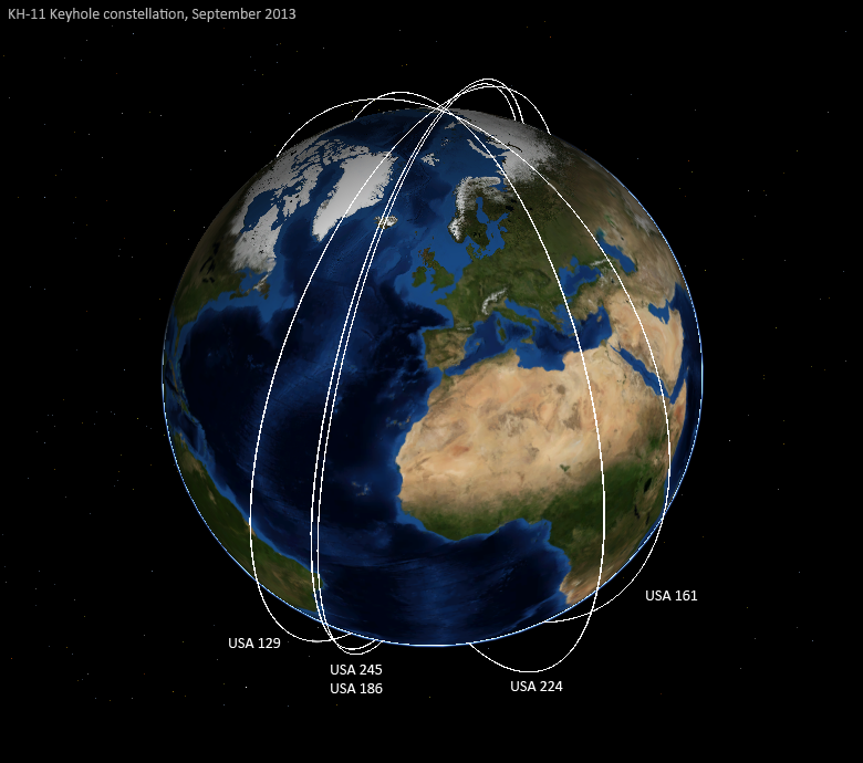
    The image almost certainly came from a satellite known as USA 224, according to Marco Langbroek, a satellite-tracker based in the Netherlands. The satellite was launched by the National Reconnaissance Office in 2011. Almost everything about it remains highly classified, but Langbroek says that based on its size and orbit, most observers believe USA 224 is one of America's multibillion-dollar KH-11 reconnaissance satellites.

    "It's basically a very large telescope, not unlike the Hubble Space Telescope," Langbroek says. "But instead of looking up to the stars, it looks down to the earth's surface and makes very detailed images."

    The image tweeted by Trump on Friday, showing the aftermath of an accident at Iran's Imam Khomeini Space Center, was so detailed that some experts doubted whether it really could have come from a satellite high above the planet.

    Iran had been preparing to launch a rocket known as the Safir with a small satellite aboard, but experts believe it exploded during fueling. The image showed crisp writing painted on the edge of the launch pad, the scorched truck that had been used to move the rocket, and other details.

    Trump seemed to be using the sensitive reconnaissance image to troll the Iranians. "The United States of America was not involved in the catastrophic accident during final launch preparations for the Safir SLV Launch at Semnan Launch Site One in Iran," the President tweeted. "I wish Iran best wishes and good luck in determining what happened at Site One."

    But a small community of amateur satellite trackers was far more interested in the picture than the words. These individuals use backyard telescopes to watch satellites whizzing across the sky, and they know where most of them are—even classified ones like USA 224. "They're super bright in the sky and are easy to find," says Michael Thompson, a graduate student in astrodynamics at Purdue University who spots satellites in his spare time. Once a satellite is seen, it's relatively easy to work out exactly where it will be at any point in future. "Using math to calculate an orbit is really easy," he says.

    Thompson was one of the first to use an amateur-curated database of known satellites to point the finger at USA 224. He showed it flew over the Iranian space center shortly after the accident.

    Langbroek went further still. He was able to reconstruct the picture taken by USA 224 by matching the obliqueness of the circular launch pad in the image tweeted by Trump. His calculation showed that the photo was taken from the vantage of USA 224. Langbroek and another online researcher, Christiaan Triebert, also used shadows cast by towers around the launch pad as sun dials—allowing them to verify the time at which the photo was taken.

    Both techniques suggest the pictures were snapped by USA 224, which flew near the site at 2:14 PM local time. "The match was perfect, basically," Langbroek says.

    Prior to the analysis, some experts suspected the image in Trump's tweet might have come from a drone or a spy plane.

    "When I saw the image, it was so crystal clear and high-resolution that I did not believe it could come from a satellite," says Melissa Hanham, a satellite imagery expert and deputy director of the Open Nuclear Network in Vienna, Austria. But she finds the new analysis persuasive. "Given that the satellite is in position at that moment, it's now very likely that it was [the source of the picture]," she says.

    Hanham says she is amazed a satellite can provide such clear imagery. Spy satellites must peer down through earth's atmosphere, which is a bit like trying to look at objects in the bottom of a swimming pool. They also must snap their pictures while whizzing across the sky. Both effects can blur the fine details in images.

    "I'm now scratching my head and curious about how they account for the effects of the atmosphere and motion of the objects," she says.

    And she says she thinks she's not alone. Others will be trying to use the image to learn more about how USA 224 works. "I imagine adversaries are going to take a look at this image and reverse-engineer it to figure out how the sensor itself works and what kind of post-production techniques they're using," she says.

    Hanham questions whether Trump's tweet zinging the Iranians was worth the information this image provides to other nations, but she adds: "It's his decision as the president."

    https://en.wikipedia.org/wiki/USA-224

    After the failure of the Boeing led Future Imagery Architecture program in 2005, NRO ordered two additional legacy hardware KH-11s. Critics of the decision voiced concerns that each "exquisite-class"[2] satellite would cost more than the latest Nimitz class aircraft carrier (CVN-77), which had a projected procurement cost of US$6.35 billion as of May 2005.[3][4] USA-224 – the first of these two – was completed by Lockheed US$2 billion under the initial budget estimate, and two years ahead of schedule.[5] USA-224 was launched atop a Delta IV Heavy rocket from Space Launch Complex 6 at the Vandenberg Air Force Base in California. The launch was conducted by United Launch Alliance, and was the first flight of a Delta IV Heavy from Vandenberg.[6] Liftoff occurred on 20 January 2011 at 21:10:30 UTC.[7] Upon reaching orbit, the satellite received the International Designator 2011-002A.[8] The early launch of USA-224, and operational changes to extend the lifetime of its predecessor USA-161, reduced the coverage gap caused by the end of the primary mission of USA-161 to just 33 days.[5]

    As the fifteenth KH-11 satellite to be launched, USA-224 is a member of one of the later block configurations occasionally identified as being a separate system. Details of its mission and orbit are classified, however amateur observers have identified it as being in a low Earth orbit and tracked it. Shortly after launch it was in an orbit with a perigee of 251 kilometres (156 mi), an apogee of 1,023 kilometres (636 mi) and 97.9 degrees of inclination, typical for an operational KH-11 satellite.[9] By April it was 260 by 987 kilometres (162 by 613 mi) at 97.93 degrees.[10] As of 5 August 2014, it is in a 270 by 986 kilometres (168 by 613 mi) orbit with inclination of 97.92 degrees and an orbital period of 97.13 minutes.
    Last edited by Zippyjuan; 09-02-2019 at 11:57 AM.


  28. Remove this section of ads by registering.
  29. #25
    Quote Originally Posted by r3volution 3.0 View Post
    The important point isn't the classification, it's that Trump's continuing to stir things up with Iran.

    Yep- and just imagine the Trump uproar if the Iranians had posted a pic of a US rocket explosion/facility/whatever.
    There is no spoon.

  30. #26
    Quote Originally Posted by Ender View Post
    Yep- and just imagine the Trump uproar if the Iranians had posted a pic of a US rocket explosion/facility/whatever.
    That would warrant at least three strongly worded tweets.


Similar Threads

  1. Trump to Stop Tweeting about Russian Investigation?
    By Zippyjuan in forum U.S. Political News
    Replies: 3
    Last Post: 05-29-2018, 06:50 PM
  2. If Donald Trump was tweeting during Biblical times..
    By Origanalist in forum 2016 Presidential Election: GOP & Dem
    Replies: 5
    Last Post: 06-18-2016, 03:04 PM
  3. Explosion at Iran Nuke Site
    By orenbus in forum U.S. Political News
    Replies: 3
    Last Post: 10-06-2014, 05:42 PM
  4. 'Die Welt': Iran building rocket bases in Venezuela
    By hillbilly123069 in forum World News & Affairs
    Replies: 4
    Last Post: 05-17-2011, 02:32 PM
  5. Iran launches rocket into space
    By Mesogen in forum World News & Affairs
    Replies: 1
    Last Post: 02-04-2008, 01:41 PM

Posting Permissions

  • You may not post new threads
  • You may not post replies
  • You may not post attachments
  • You may not edit your posts
  •